 Unseen Bangladesh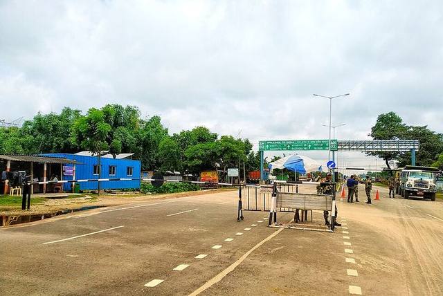
Panchagarh District · Rangpur Division · বাংলাবান্ধা জিরো পয়েন্ট
Banglabandha Zero Point travel guide
The country's northernmost point; a land port for trade with Nepal and Bhutan.
🗓️ Best time to visitOctober–March
⏱ How long it takes1–2 hours
💰 Estimated costFree
At a glance
- Location
- Bangladesh's northernmost point
- Land port
- Opened 1997 (trade with Nepal)
- Across the border
- Phulbari and Siliguri, India
- Ceremony
- Afternoon flag lowering (retreat)
History and details
Banglabandha union in Tetulia is the northernmost tip of Bangladesh's map; a 'Zero Point' marker shows where Bangladesh begins. Siliguri in India is only a few kilometres away, and the borders of Nepal and Bhutan are very close.
Banglabandha Land Port opened in 1997 mainly for trade with Nepal across Indian territory; later trade with India and Bhutan and passenger crossings began. Its potential as a hub for four-country trade and tourism is growing.
Things to do
- Take photos in front of the zero point marker
- Watch the afternoon flag-lowering ceremony at the border
- See the Mohananda River and tea gardens on the way
How to get to Banglabandha Zero Point
About 17 km from Tetulia.
Panchagarh is about 440 km from Dhaka; the journey takes 9–10 hours.
- 🚌 By bus: Nabil, Hanif, Shyamoli (Panchagarh/Tetulia) from Gabtoli/Mohakhali, non-AC ৳900–1,100, AC ৳1,500–2,000.
- 🚆 By train: Panchagarh Express/Ekota/Drutojan from Kamalapur, fare ৳550–1,600.
- ✈️ By air: Via Saidpur, then about 2.5 hours by bus/car.
Where to stay
- Tetulia Dak Bungalow and Zila Parishad rest house (with permission)
- Several guesthouses in Tetulia including Mohananda Cottage
What to eat
Organic tea, rice from local Boro paddy
Good to know
- Take a photo at the zero point marker
- Follow BGB instructions in the border area
More to see nearby
- Tetulia Dak Bungalow (17 km)
- Tetulia's tea gardens
- Mohananda River
More places to visit in Panchagarh district
- Kanchenjunga from Tetulia — Snow-capped Kanchenjunga from the Mohananda bank on clear October–November mornings.
- Tetulia's tea gardens — Flatland tea gardens, green to the horizon.
- Bhitargarh — Ruins of a fort city about 1,500 years old, and the Maharaja's Dighi.