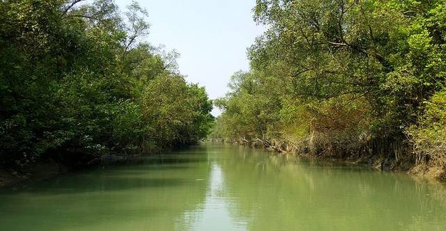
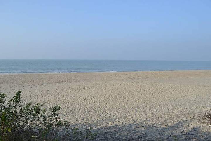
From Cloud to Seabed: Bangladesh's Nature, Seen From the Inside in 10 Pictures
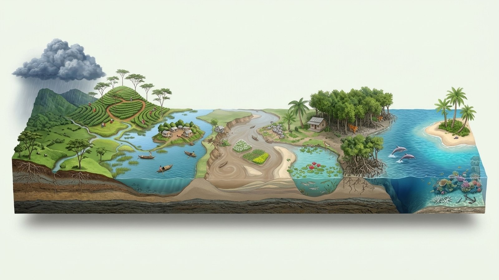
What would you see if you sliced through the soil, water and forest of Bangladesh like a cake? From monsoon clouds to tea hills, haors, river chars, a village pond, the hilsa's journey, the salty coast, the Sundarbans, the Bay of Bengal and Saint Martin's coral: the inside story of the country's nature in 10 3D pictures.

- Pictures
- 10 3D cutaways
- The journey
- From monsoon clouds to the seabed
- Places
- Sylhet, the haors, the Jamuna, the coast, the Sundarbans, Saint Martin
- Reading time
- 10 minutes
- For
- Anyone who wants to see the country a little differently
Trip ticket
We know Bangladesh from above: green fields, rivers, tea hills, beaches. But what if you could cut out a piece of it like a slice of cake and look at it from the side? What do roots do under the soil, which fish live on which floor of a pond, how deep in the sea do whales swim? This post has 10 such 3D cutaway pictures, laid out like a journey: it starts with monsoon clouds gathering in the sky, then moves through the hills, the haors, the rivers, a village pond and the coast to the Sundarbans, and ends on the seabed and a coral island.
1. Monsoon clouds: where it all begins
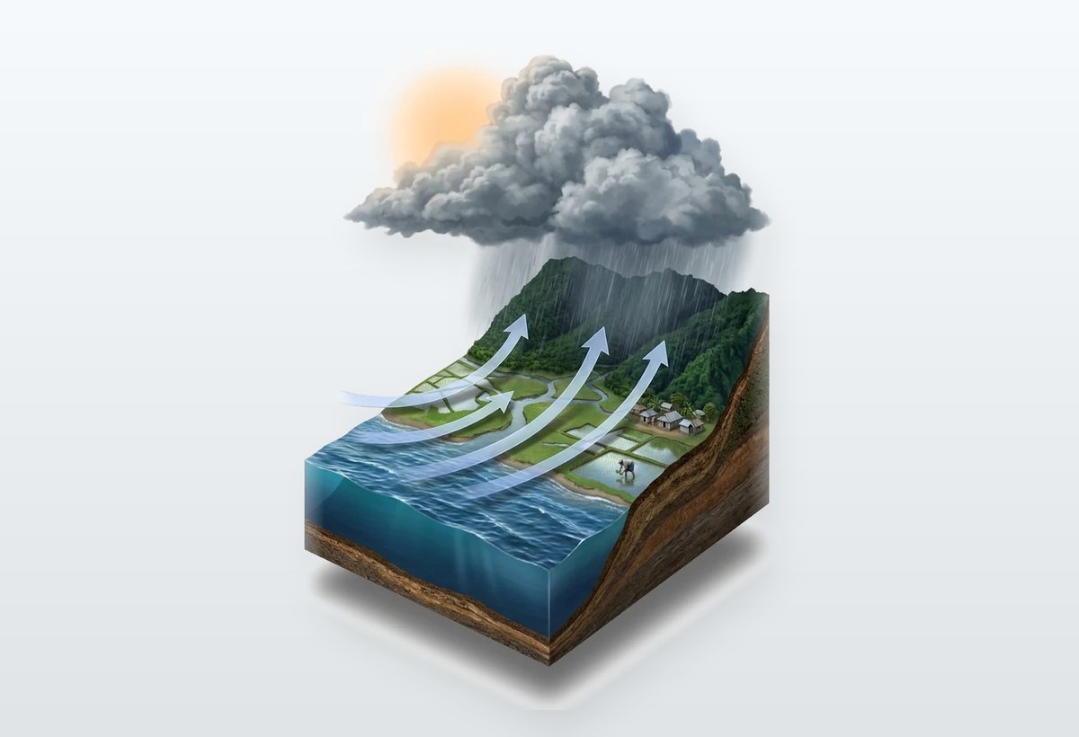
Bangladesh's rivers, rice and fish almost all begin in one place: the monsoon. In summer the land heats up faster than the sea, so wet air from the Bay of Bengal rushes inland from the south-west.
- When it arrives: the monsoon first enters through Teknaf, normally around 2 June. The rainy season runs from June to September.
- How much rain: more than 70 percent of the year's rain falls in these four months.
- Clouds caught by hills: the Meghalaya hills push the wet air up, where it cools and falls as rain. Cherrapunji gets about 10,000 mm a year, and that water rushes down towards Sylhet and Sunamganj.
- Blessing and flood: monsoon rain grows the aman rice crop, about 38 percent of the country's rice. Yet in 1998 about two-thirds of the country went under water.
2. Tea hills: why the gardens sit on slopes
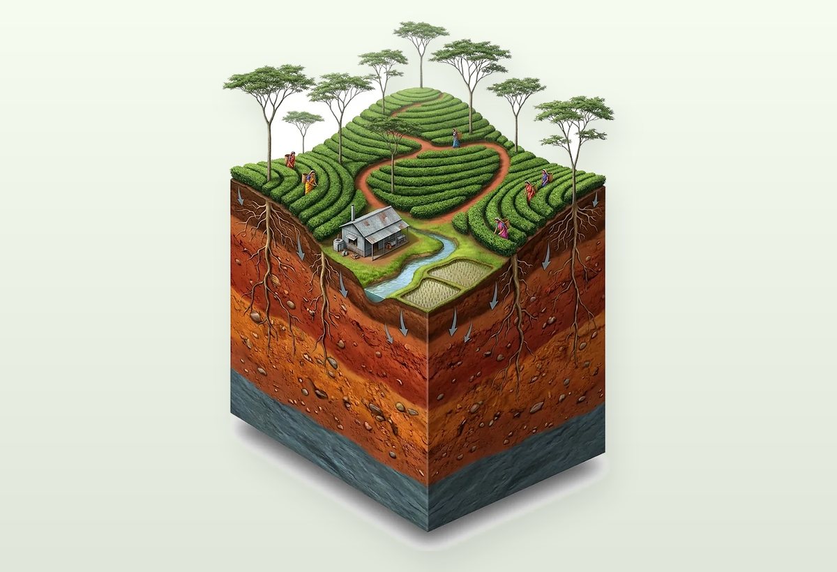
Much of that rain falls on the hills of Sylhet. Sreemangal gets about 2,400 mm a year, just right for tea. But tea loves water, not standing water.
- The secret of the slope: if water pools at the base, tea roots die, so gardens are planted on slopes where water drains away.
- Pruned bushes: left alone, a tea plant grows into a tree about 10 m tall; in the garden it is kept at waist height, flat like a table.
- Shade trees: koroi trees here and there block the sun and pull nitrogen from the air to feed the soil.
- Two leaves and a bud: only the tip is picked, and pickers return to the same bush every 7–9 days. The country has about 170 tea gardens, 92 of them in Moulvibazar.
3. Haor: one place, two faces
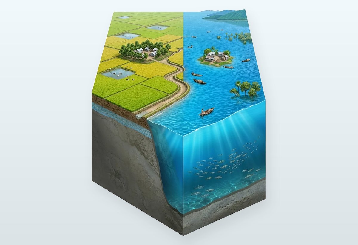
Water coming off the hills collects in huge bowl-shaped lowlands in the north-east: the haors. The left and right halves of this picture are the same place in different seasons.
- Fields in winter: once the water drains, there is one crop a year, boro rice. About a fifth of the country's boro rice comes from the haors.
- A sea in the monsoon: the whole bowl fills up, villages on raised mounds become islands, and people get around only by boat.
- The fear of early floods: heavy rain on the hills in April–May can flood the fields before the rice is cut.
- In numbers: 373 haors in 7 districts, about 8,585 km² in all, home to about 20 million people.
4. River chars: land that comes and goes
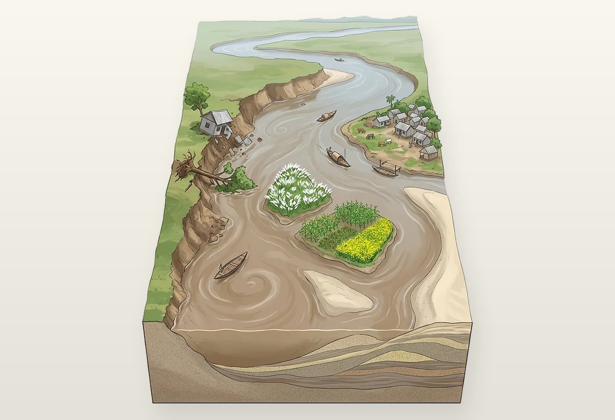
Along with the water comes sand and silt from the Himalayas, roughly 0.5–1 billion tonnes a year. When the current slows on the plains, the sand settles and a char rises in the middle of the river.
- Breaking one bank, building the other: on the outside of a bend the current eats away the bank; on the inside it slows down and drops sand, making new land.
- From sandbar to village: first kash grass, then maize, chilli, groundnut and mustard, then homes.
- The width of the Jamuna: split into many channels, it is 3 km wide in places and 20 km in others.
- The price: since 1973 the Jamuna alone has eaten about 90,000 hectares of land. Meanwhile about 17–21 km² of new land rises each year at the Meghna's mouth.
5. A village pond: who eats whom
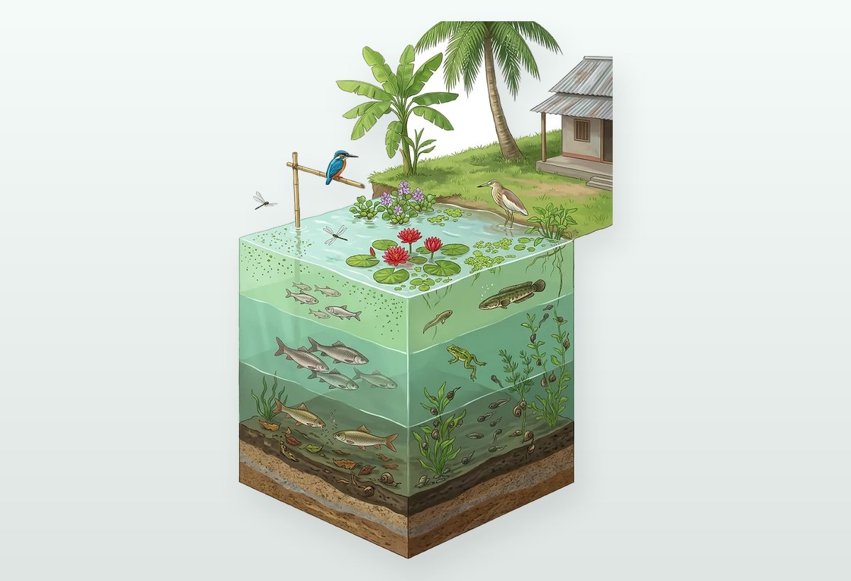
Almost every village near a river has a pond. It looks calm from outside, but a whole household runs inside, split over three floors.
- Where food begins: tiny algae, duckweed, water lilies and water spinach make food from sunlight; tiny animals eat them, and fish eat the tiny animals.
- Three floors of fish: catla and silver carp at the top, rui in the middle, mrigal at the bottom. That is why farming all three together in one pond means less fighting over food.
- The hunters: shol and taki eat tadpoles, the boal is called the freshwater shark, and the kingfisher dives in from above.
- Nothing goes to waste: bacteria in the mud break down dead leaves and animals back into nutrients.
6. The hilsa's journey: born in the river, grown in the sea
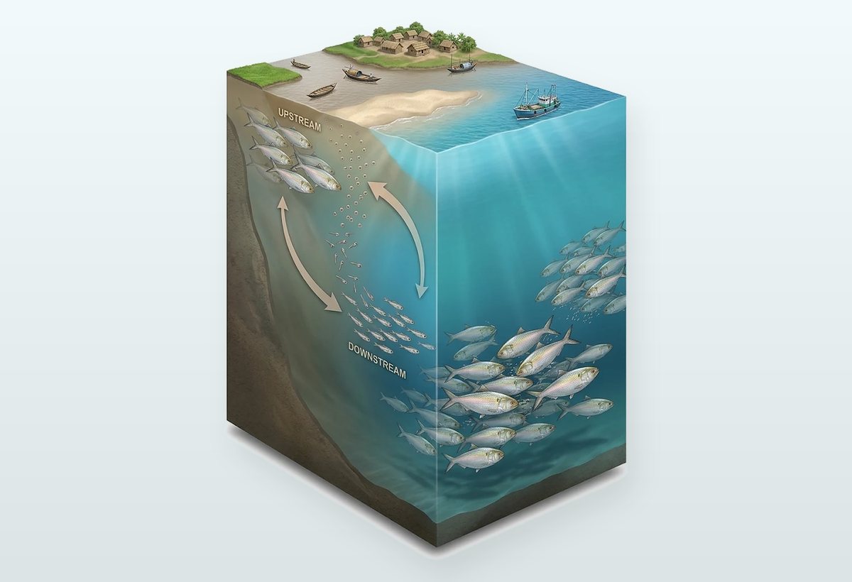
Heading from river to sea, you meet the country's most famous traveller: the hilsa. Its whole life is a back-and-forth between river and sea.
- Upriver to spawn: the main season is around the full moon of Ashwin, September–October. The main breeding grounds are around Bhola and Monpura, about 7,000 km².
- Jatka: the eggs hatch in about a day. Young hilsa under 25 cm, called jatka, grow in the river for a while and then go down to the sea.
- Growing up at sea: they become adults in 1–2 years, usually 35–40 cm long.
- The payoff of a pause: fishing for hilsa stops for 22 days during spawning. The catch rose from about 0.2 million tonnes in 2002-03 to 0.529 million tonnes in 2023-24.
7. The salty coast: thirst in a land of water
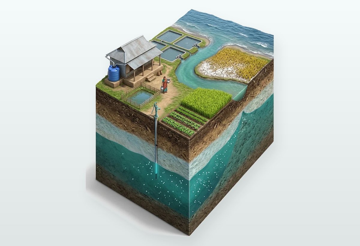
Near the sea the water does not change colour, but it changes taste. On the south-west coast there is water all around, yet drinkable water is hard to find.
- Where the salt comes from: tides push salt water up rivers and canals twice a day. In the dry season less fresh water comes from upstream, so the salt reaches further inland.
- After a storm: storm surges top the embankments and pour salt water into ponds; after Cyclone Aila in 2009 many drinking-water ponds were ruined.
- Saline land is growing: from 0.833 million hectares in 1973 to 1.056 million hectares in 2009, about 26% more in 36 years.
- Adapting: storing rainwater, salt-tolerant rice (starting with BRRI dhan47), and sorjan farming with vegetables on raised beds and fish in the ditches.
8. The Sundarbans: roots that breathe
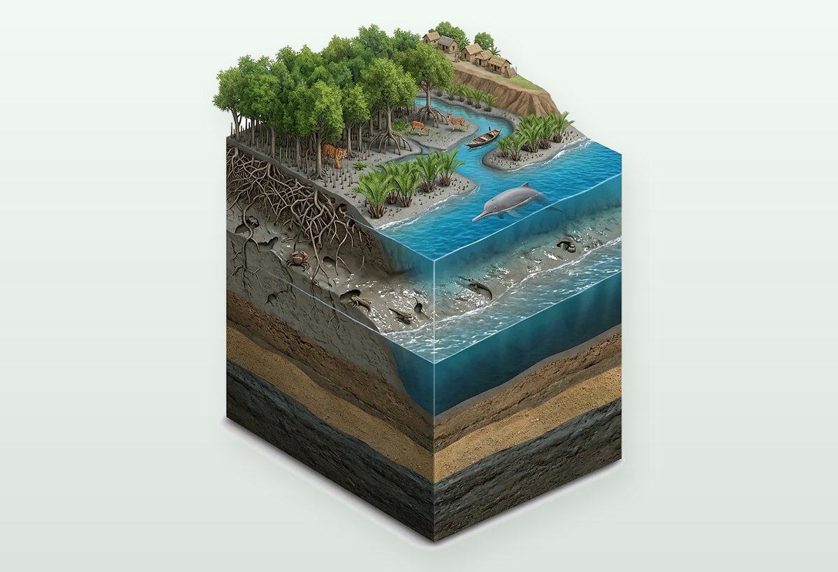
At the end of the coast lies the world's largest mangrove forest. The tide-soaked mud holds almost no oxygen, so the trees here have learned to live differently.
- Breathing roots: sundari and keora roots push up out of the mud and take in air at low tide. Garjan stands on arching stilt roots.
- Two tides a day: the water rises and falls about every 12½ hours, about 3 m at the coast.
- Life in the mud and water: mud crabs and mudskippers in the mud, Ganges and Irrawaddy dolphins in the creeks.
- A shield against storms: during Cyclone Sidr in 2007 the forest greatly reduced the damage to villages behind it. The Bangladesh part covers 6,017 km² and has 125 tigers (2024 survey).
9. The Bay of Bengal: life in layers
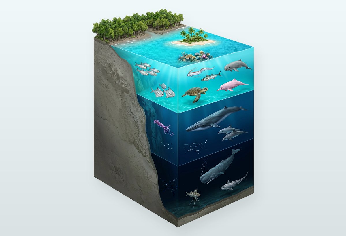
Past the forest, the sea is another world, split into three floors by depth. The Bay of Bengal covers about 2.2 million km².
- Sunlit zone (0–200 m): sunlight reaches here. Hilsa, pomfret, Bombay duck, Irrawaddy and pink dolphins, olive ridley turtles.
- Twilight zone (200–1,000 m): faint blue light. Bryde's whales, bottlenose and spinner dolphins, lanternfish.
- Dark zone (below 1,000 m): no sunlight at all. Sperm whales dive here to hunt, and tripod fish rest on the floor.
- Swatch of No Ground: an undersea canyon about 1,200 m deep, the country's first marine protected area (2014).
10. Saint Martin: the country's only coral island
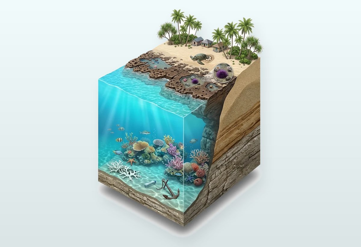
The last stop is a small island at the country's southern tip. Many think it is made of coral; in fact its base is old sandstone, and the coral grows on that rock.
- A world revealed at low tide: a few hundred metres of rocky shore appear at low tide; the pools hold sea anemones, sea urchins and hermit crabs.
- Coral and creatures: about 66 species of coral and more than 230 species of fish; olive ridley turtles nest on the beach in winter.
- Why it is fragile: the island is only about 3.6 m above the sea and about 8 km² in size. Anchors, building, plastic and coral bleaching in warmer seas are big threats.
- Visiting rules: in the 2026–27 season the island is open 1 November–15 March, with at most 3,500 visitors a day. Read more in Saint Martin travel rules.
10 pictures, one story
Put side by side, these are different places but one story: monsoon water washes off the hills and fills the haors, rivers carry that water and silt to build chars, fill ponds and guide the hilsa, then meet salt water at the coast and flow past the Sundarbans into the sea. Change one, and the rest feel the pull. These pictures come from the pages of our "Bangladesh 3D Atlas", where many more pictures like these show the country from the inside.
Want the whole atlas?
 From Map BangladeshGet the whole Bangladesh 3D AtlasThe 10 pictures in this post are only a few pages of the atlas. The whole atlas has 50 3D infographics in 8 chapters, rivers, forests, the sea, cities and much more, as two PDFs in Bangla and English.50 infographics8 chapters61 pagesBangla & EnglishBuy it on Map Bangladesh →mapbangladesh.com/atlas
Questions and answers
When does the monsoon arrive in Bangladesh?
The monsoon usually enters through Teknaf around 2 June. The Meteorological Department counts June to September as the rainy season, and more than 70 percent of the year's rain falls then.
What is a haor, and how many are there in Bangladesh?
A bowl-shaped lowland between two rivers that fills with water in the monsoon. There are 373 haors, in Sunamganj, Habiganj, Moulvibazar, Sylhet, Netrokona, Kishoreganj and Brahmanbaria.
Why do Sundarbans tree roots grow up out of the ground?
The tide-soaked mud holds almost no oxygen, so trees like sundari and keora send roots up out of the mud (breathing roots) to take in air at low tide.
Is Saint Martin's Island made of coral?
No. Its base is old sandstone, topped with limestone made of shells and coral, and sand. Coral grows on the rock, which makes it the country's only coral-rich island.
Why is coastal water getting saltier?
Tides push sea water into rivers and canals, less fresh water comes from upstream in the dry season, storm surges top the embankments, and shrimp farms leave salt in the soil. Saline land grew by about 26% between 1973 and 2009.
Full guides to the places in this post
Sundarbans (tours from Khulna)Sundarbans, Munshiganj-Kalagachhia

See it on the map, plan your trip
Look up the places, routes and costs, then put your own trip together.